Published 25 Jan, 2019
Satellite and Drone Data Analyses Take the Development of TEN-T to New Heights
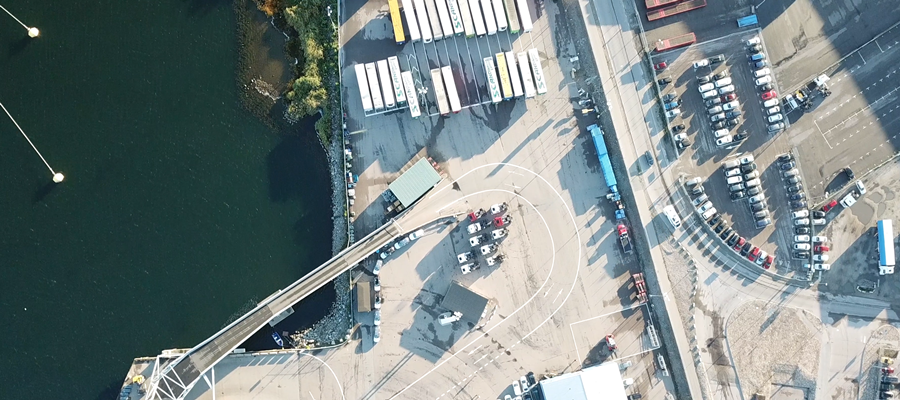
Regional growth is of great importance in the EU transport policy instrument on the major transport axes across Europe i.e. the Trans - European Transport Network (TEN-T) Core Network Corridors (CNC). The TENTacle project aims to further improve the planning process and infrastructures measures. One of the pilot cases looked into the feasibility of new technology based on air- or satellite-borne Synthetic Aperture Radar technology (SAR) to take over future measurement tasks of the TEN-T network. By using such means, infrastructure bottlenecks - for example in ports - can be identified more easily and therefore support the improvement of terminals or the development of road and rail networks.
Soon, the technology will be able to compare different parts and contribute to sustainable development and to the extension and improvement of the CNCs.
Within the framework of the TENTacle project, Blekinge Institute of Technology (BTH), Sweden, has worked to exemplify how this new technology and modern data processing (such as Artificial Intelligence and Big Data) can be used to analyze good flows in terminals and harbors.
The goal is to find objective measures that in turn can lead to improvements in the handling of goods, docking embodiment frequency, port to port costs, and administrative tasks.
Blekinge Institute of Technology (BTH) proposes the use of new geospatial technologies and “Pixel-to-People”-measurements, i.e. to conduct analyzes without any hardware investments along the EU corridors. In the future, stakeholders and decision-makers of and along the CNCs can easily get access to satellite measurements to get better and more importantly live data on the traffic axes.
For more information please contact:
Mats Pettersson
Blekinge Institute of Technology
mats.pettersson@bth.se